Mapping data Geographically

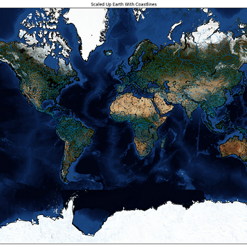
Basemap is a powerful yet simple tool for python and allows to plot visualizations geography-wise by providing coordinates. This quick tutorial is a good example of syntax usage and technique references of drawing a basemap via Mercator projection. To achieve that we require coordinates such as Latitude and Longitude. A... [Read More]

Prepare Datasets cheatsheet

This is a Cheatsheet, meaning it contains code snippets. Based on Data Exploration course from Dataquest. Often Dataset Preparation consists of combining several messy data sets into a single clean one to make further analysis easier. It is always good to get acquainted with the topic on the domain the... [Read More]

My First Post

Hello World! Hope to get some happy-blog-birthday comments :)